WORK
QGIS Project: Housing Analysis in Sydney LGAs
Ever wondered where were maximum houses purchased till 2021? This map illustrates the number of houses purchased in 2021. According to data from the Australian Bureau of Statistics (Census 2021), the highest number of house purchases occurred in the postcodes 2145, 2153, 2155, 2170, 2250, 2259, 2261, 2560, 2570 and 2650.
In this analysis, the term 'houses' refers to the combined total of dwellings classified as: Separate houses; semi-detached, row or terrace houses, townhouses etc. with one storey; and semi-detached, row or terrace houses, townhouses etc. with two or more storeys.
Suburbs/Area names for each of the listed postcodes:
- 2145 – Westmead / Wentworthville / Greystanes
- 2153 – Baulkham Hills
- 2155 – Rouse Hill / Kellyville
- 2170 – Liverpool
- 2250 – Gosford / Narara / Wyoming
- 2259 – Wyong / Tuggerah / Warnervale
- 2261 – Bateau Bay / The Entrance
- 2560 – Campbelltown
- 2570 – Camden / Oran Park
- 2650 – Wagga Wagga
Urban Planning Analysis
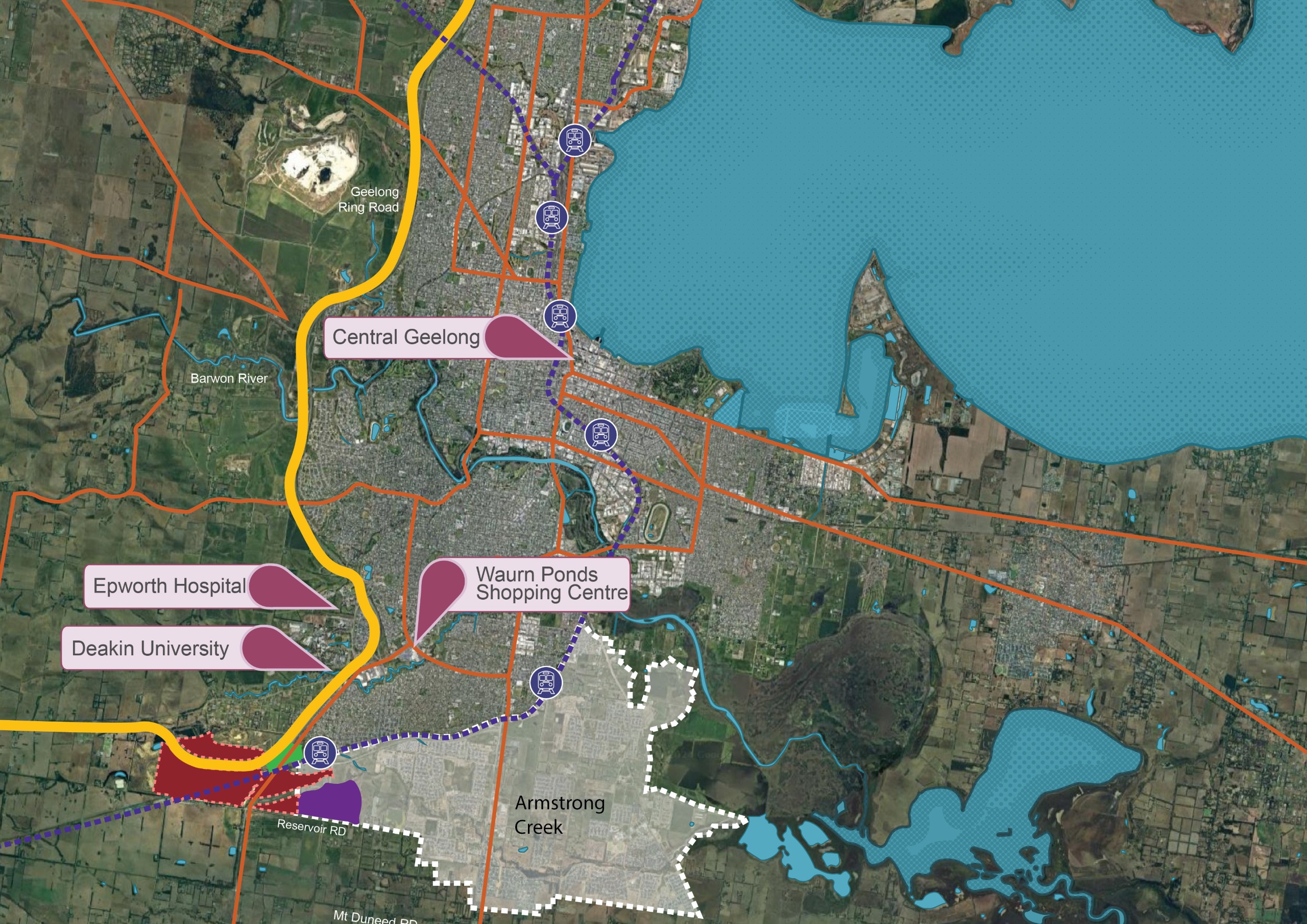
Boral owns a 1,020-hectare site at Waurn Ponds, Geelong, formerly used for quarrying. With extraction activities winding down, the site is now earmarked for redevelopment. Macroplan, a leading urban economics and planning consultancy, has been engaged to deliver a planning pathway and development strategy, assessing potential mixed uses including residential, commercial, industrial, tourism, and recreation.
I contributed to this project by assisting Macroplan in the creation of South-West Geelong Investigation Precinct maps, which were instrumental in defining land-use opportunities and guiding strategic planning discussions.